Apr 2025 AM TCN
Q.1) A vessel steering 255°(T) at 12 knots, observes Olands Sudra Grund Lt. (56° 04’N, 016° 41’E) bearing 005°(T) at 2000 hrs and 040°(T) and 2100 hrs. At 2215 hrs Utklippan Lt. (55° 57’N, 015° 42’E) bore 355° (T). If the hrs current during the above period was setting 239°(T). Find:
i) Position of ship at 2000 hrs, 2100 hrs and 2215
ii) CMG and SMG and
iii) Rate of current.
Answer:

2000 Hrs Posn: 55°51’N; 016°38.8’E
2100 Hrs Posn: 55°46.7’N; 016°14.6’E
2215 Hrs Posn: 55°41.6’N; 015°44.5’E
CMG – 252°T; SMG – 14.3 Kts
Rate – 2.3 Kts
Q.2) At 1000 hrs while steering 300°(T), the vessel observed Sandhemaran Lt. Ho. (55°23.5’N,
014°11.5’E) bearing 30° on her starboard bow and at 1025 hrs abeam. From this position, find
compass course to steer to pass Kullagrund Lt. Ho. (55° 18’N, 013° 20’E) 5 miles off to starboard counteracting a current estimated to set South at 3 knots and leeway of 3° caused by southerly wind.
Answer:
1000 hrs – 30° Stbd bow – 300+30=330°T
1025 hrs – Abeam – 300+90=030°T
Engine Speed for 25 mins = 5 kts

CTS – 268°T
Leeway Track – 265°T
Variation – 2°W
Deviation Card No 3 from CL Dubey book taken
Compass heading Deviation Magnetic Heading
270 5W 265
280 5.5W 274.5
By Interpolation Deviation For Mag heading – 5.1W
Compass CTS – 272.1° (C)
Q.3) A 2200 hrs vessel dropped pilot at Simrishamn pilot station (55° 34’ N, 014° 24’E). She intends to join the West bound lane of TSS off falseterbore Racon (55° 18.5’N, 012°39.5’E). Plot safe course on chart with draft 10 m and UKC of 2.0m throughout, GPS not working, gale force winds expected during the passage. Plan your passage giving details of what equipment and landmarks you would use.
Plan the Passage as per the question
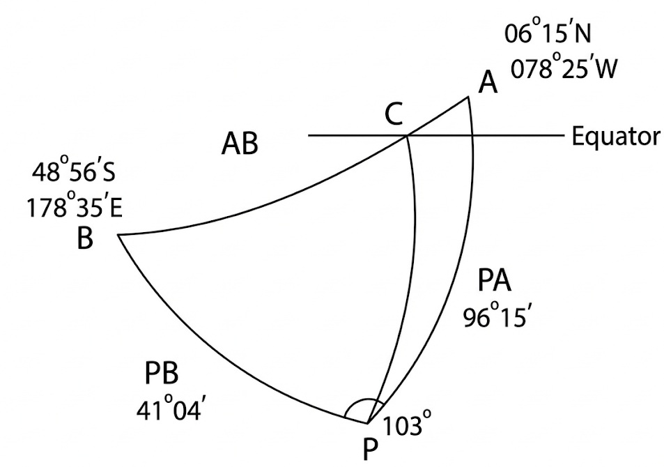
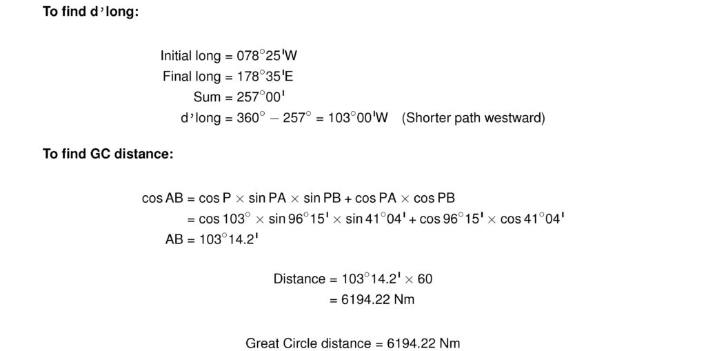
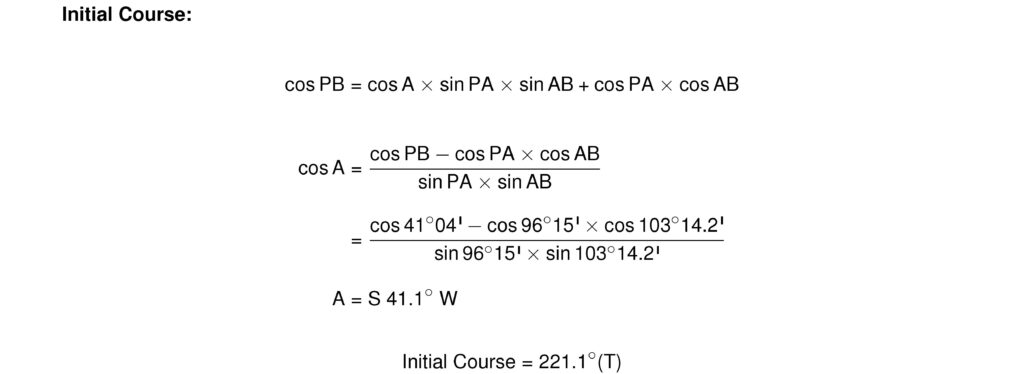
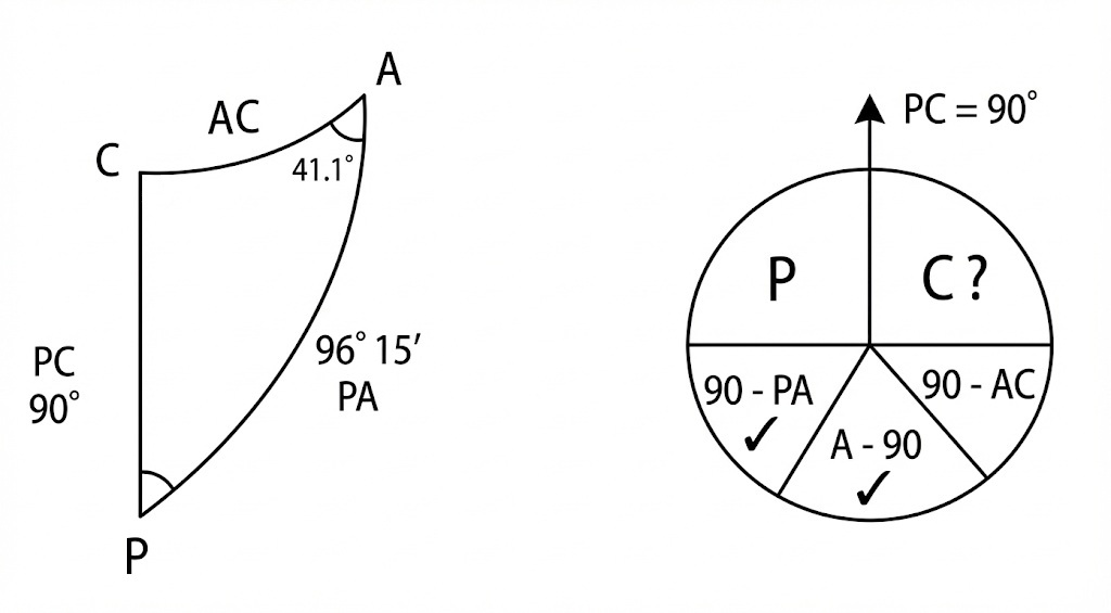
Q.4) Find the GC distance, from 06°15’N, 078°25’W to 48°56’S 178°35’E. Also find the course of the vessel as it crosses the equator on the GC track.
Answer:


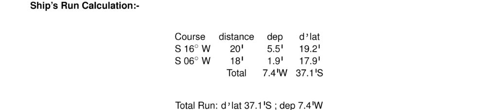
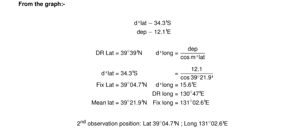
Q.5) In D.R. position 39°39’N 130°047’E an observation of the Sun gave an intercept 4’ towards, bearing 160°(T). A second observation using latitude 39°09’N gave a longitude of 130°47’E, bearing 200°(T). Find the ships position at the second observation, if during the interval the ship ran 196°(T) x 20 miles and 186°(T) x 18 Miles.
Answer:
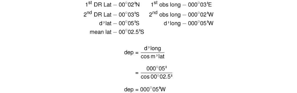
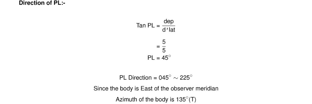
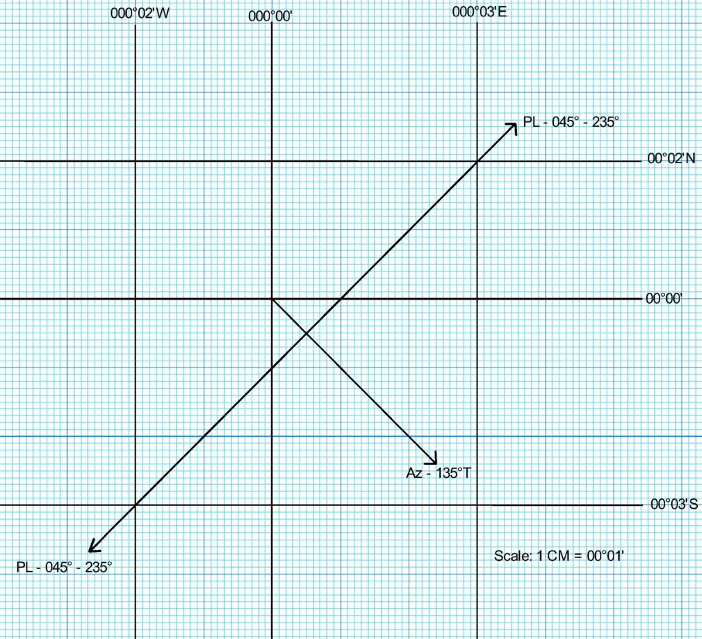
Q.6) Using DR Latitude of 00° 02’N, an Observed Longitude of 000° 03’E was obtained. When the same sight was worked using DR Latitude of 00° 03’S, the Observed Longitude of 000° 02’W was obtained. Find the Azimuth of the body, if it was East of the Observer’s Meridian.
Answer:
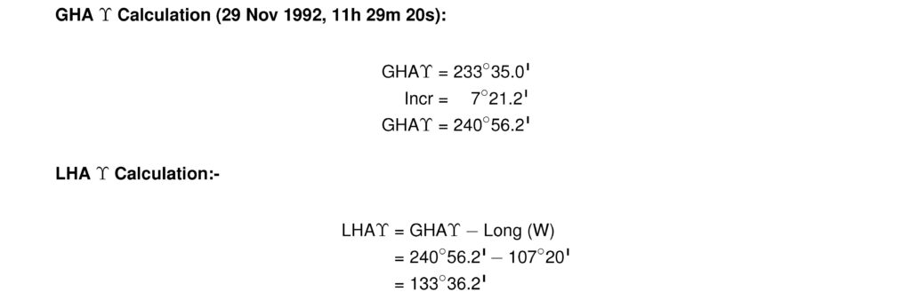
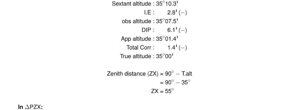
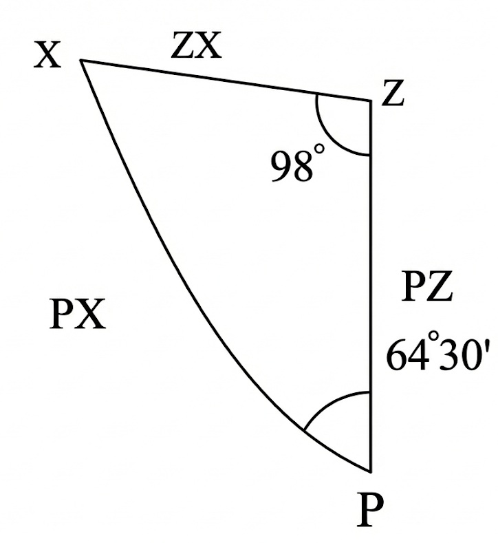
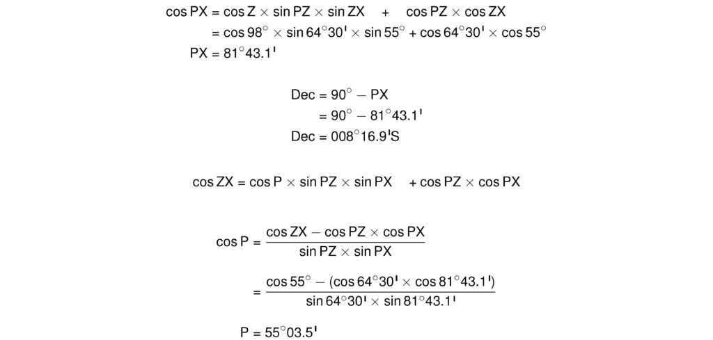
Q.7) On 29th November 1992, AM at ship, in DR 25° 30’S, 107° 20’W, the sextant altitude of an unidentified star bearing 278°(T) was 35° 10.3’. GMT 29d 11h 29m 20s. I.E. 2.8’ on the Arc, H.E. 12m. Identify the star.
Answer: